|
|
The Legacy of Walter W. Ristow
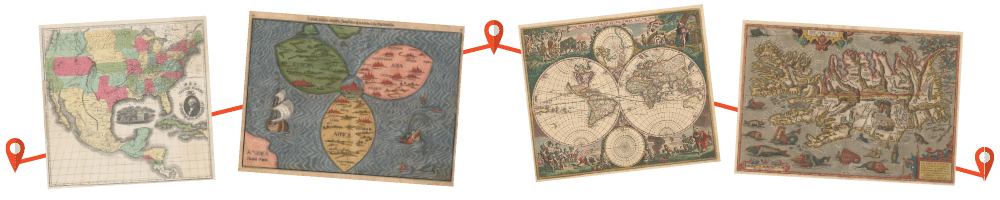
During Wally’s distinguished professional career, which spanned a remarkable seven decades, he inspired and taught countless other individuals by his original research, writing, committee work, active participation in several professional societies, and leadership of two of the world’s great map libraries – the Map Division of the New York Public Library (1937-1946) and the Geography and Map Division of the Library of Congress (1946-1970). Additionally, he headed the geography and map section of the U. S. Army’s New York City Office of Military Intelligence for 32 months during World War II in a civilian capacity while continuing his duties with the New York Public Library on a part-time basis. From my perspective, Wally made significant contributions to three related fields - geography, map librarianship, and historical cartography – and I would like to briefly comment on each. Geography Wally’s association with professional geography began during his undergraduate days at the University of Wisconsin where he studied with some of the founding fathers of modern American geography – Vernor C. Finch, Glenn Trewartha, and Armin Lobeck. This was followed by a teaching assistantship in the Geology and Geography Department at Oberlin College, Ohio, and graduate studies at the Clark University Graduate School of Geography in Worcester, Massachusetts. His first contribution to the field was an article on “The influence of geography upon the history of Bohemia,” which appeared in the Bulletin of the Geographical Society of Philadelphia in 1933, the same year that he received his M. A. degree from Oberlin College. It was the first of more than 250 published articles, notes, and books that would flow almost effortlessly from Wally’s pen. Wally practiced what he called the “practical side of the science of geography,” which he defined as working with government and professional organizations to “dispense cartographic and geographic information.” During his association with the New York Public Library and the Library of Congress he prepared numerous carto-bibliographies and acquisitions lists to inform the public about the map holdings of these two great institutions. Wally also promoted geography though participation with professional organizations. He played a critical role in the creation of the reconstituted Association of American Geographers in 1949 following its merger with the American Society for Professional Geographers, an organization established in 1943 by younger wartime geographers. Wally served as the last secretary of the ASPG and the first secretary of the new AAG, whose central office was moved to the Geography and Map Division of the Library of Congress in 1950 where it was housed for nearly a decade. He also represented the Library of Congress on the U. S. Board on Geographic Names for eighteen years, serving as chairman for one term. Established in 1890, the BGN is the final authority for naming geographical features in the United States. Other notable committee work assignments included chairmanship of the Middle Atlantic Division of the AAG and co-organizer of the first U. S. Federal Map Users Conference in 1965. Wally’s contribution to the “practical side” of geography took on international significance in 1949 when he represented the Library of Congress at the Pan American Institute of Geography and History in Rio de Janeiro. This was followed by a two-year leave of absence from the Library during which time Wally directed the planning and scheduling of the Seventeenth International Geographical Congress, which was held in Washington in 1952. More than one thousand geographers participated. Map Librarianship Although Wally began his career in map librarianship without formal training in either cartography or library science, he became a leading figure in the field. He was one of the first to actively promote map librarianship as a profession. His paper, “The Library Map Collection,” which appeared in the June 15, 1942, issue of Library Journal, is one of the earliest papers on this subject to appear in an American library publication in the United States. Wally played leading roles in founding the first professional map library society in the U.S - the Geography and Map Section of the Special Libraries Association - and its international counterpart, the Geography and Map Libraries Section of the International Federation of Library Associations. Under his direction, the Library of Congress became the worldwide leader in automated map cataloging. In 1978, the Geography and Map Library Section of IFLA honored Wally with a Festschrift on his 70th birthday “for his 40 years of distinguished service to map librarianship.” Historical Cartography Finally, Wally contributed significantly to the emergence of historical cartography as a distinct field of scholarship in the United States through his numerous publications and the co-founding of the Washington Map Society. Wally’s breadth of interest in the history of cartography was simply amazing. He had the unique ability to popularize the subject for a general audience. He explored new avenues of historical cartographic research, most notably oil company road maps, aviation cartography, and journalistic mapping. In a series of profiles on early American mapmakers that appeared over several decades in the quarterly journals of the Library of Congress and the American Congress on Surveying and Mapping, he traced the development of American commercial cartography, which he later expanded for his landmark 1985 book, American Maps and Mapmakers. Walter W. Ristow was the epitome of the scholar-manager, a person who combined an inquisitive mind, superb research skills, a flair for writing, and rare administrative and organizational abilities. Dr. Ristow will be sorely missed, but he will continue to inspire and instruct through his unique body of work, and through the Walter W. Ristow Prize in the History of Cartography, which has been awarded annually since 1994 by the Washington Map Society, and the Walter Ristow Fund at the Library of Congress, generously established by the Ristow Family “to support the work of the Geography and Map Division [and] American cartography.” --Ralph Ehrenberg is retired Chief of the Geography and Map Division, Library of Congress. He delivered these remarks at the Ristow Memorial Service at the Falls Church Presbyterian Church, Falls Church, VA on May 7, 2006. |
Dr. Walter W. Ristow |

© 2021 Washington Map Society. All Rights Reserved. |
|