|
|
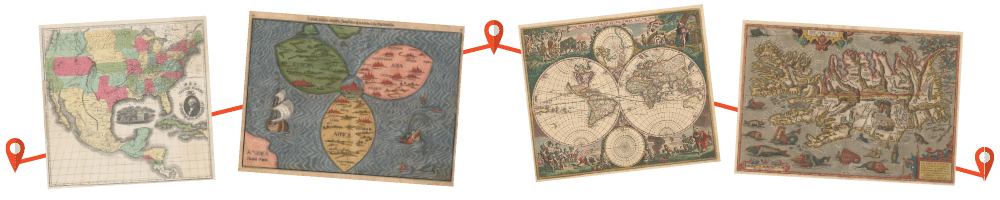
Places to See Maps There are an incredible number of places around the world, both physical and digital, to view maps covering the entire history of cartography. There are two key websites that provide the long listings of the many physical locations to visit, with their web addresses provided below. With some of the greatest exhibits and collections of maps in the world in Washington, D.C., local WMS members have written a detailed and informative compilation of what to see and where to go. Additionally, from your computer or your device, there are a vast number of sites around the globe that showcase collections, many of which are listed in this guide. AROUND THE UNITED STATES AND THE WORLD Online Guide To U.S. Map Collections is a directory (featuring a map!) of map collections, big and small, across the country. Visit Online Guide to U.S. Map Collections (arcgis.com) For a global perspective, see a listing of current map Exhibitions and map meetings around the world at Cartography - Calendar of Meetings and Exhibitions (docktor.com), a constantly updated listing, maintained by Washington Map Society member John Docktor. Map aficionados should refer to that website before commencing any travels in hope of seeing maps during the journey. Below are listed locations in the Washington, D.C. region that have maps on display, and locations where researchers can visit to do specialized research. Some of the research centers have materials available at their websites for viewing and download. A more complete list of libraries, archives, and organizations in the DC area that hold maps can be found in Ralph E. Ehrenberg’s, Scholars’ Guide to Washington, D. C., Cartography and Remote Sensing Imagery (Woodrow Wilson International Center for Scholars, no. 12) (Smithsonian Institution, 1987, 1991), 383 pp. Although somewhat dated, Ehrenberg’s Guide still provides a useful introduction to the region’s extensive holdings of historic maps and charts. It can be seen at over 250 libraries around the world and may also be purchased online.
DIGITAL COLLECTIONS TO VISIT Library of Congress (Geography and Map Division) National Oceanic & Atmospheric Administration Coast Survey's Historical Map & Chart Collection Newberry LibraryOsher Map Library, University of Southern Maine Boston Public Library, Leventhal Map Collection John Carter Brown Map Collections Brown University John Carter Brown Library : Free Texts : Free Download, Borrow and Streaming : Internet Archive The Johnson U.S. Map Project by Ira Lourie Johnson Realms of Gold: A Catalogue of Maps in the Library of the American Philosophical Society Oxford University’s Bodleian Library National Maritime Museum Collections Online: Charts & Maps from the Royal Museum, Greenwich Afriterra: The Cartographic Free Library original rare maps of Africa Historic Cities maps, literature and various other documents pertaining to its topic. Online Exhibitions - Linda Hall Library including ones about celestial maps Featured Exhibits (thedigitalgallery.org) various collections and presentations EVEN MORE ONLINE COLLECTIONS IN LIBRARIES AND ARCHIVES IN THE UNITED STATES Alabama Maps and Blueprints Collection - Alabama Department of Archives and History, Alabama State Archives Arizona Maps Online | Arizona State Library (azlibrary.gov), Arizona State Archives Maps Collection - CA History Room - California State Library, California State Archives Connecticut Digital Archive | Connect. Preserve. Share (ctdigitalarchive.org), Connecticut State Archives Historic Maps - Delaware Public Archives - State of Delaware, Delaware State Archives Maps - Division of Library and Information Services - Florida Department of State (myflorida.com), Florida State Archives Colonial Plats and Warrants - Georgia's Virtual Vault (georgiaarchives.org), Georgia State Archives District Plats of Survey - Georgia's Virtual Vault (georgiaarchives.org), Georgia State Archives Headright and Bounty Plats - Georgia's Virtual Vault (georgiaarchives.org), Georgia State Archives Historic Maps - Georgia's Virtual Vault (georgiaarchives.org), Georgia State Archives Maps (cyberdriveillinois.com), Illinois State Archives https://digital.lib.uiowa.edu/atlases/, Iowa State Archives https://www.kansasmemory.org/, Kansas State Archives https://kyhistory.com/digital/collection/Maps/search - Kentucky Historical Society https://www.sos.la.gov/HistoricalResources/PublishedDocuments/LH9MapCollections.pdf, Louisiana State Archives https://digitalmaine.com/arc_maps/, Maine State Archives https://plats.msa.maryland.gov/pages/index.aspx, Maryland State Archives https://www.familysearch.org/search/collection/2106411 & https://www.digitalcommonwealth.org/collections/commonwealth:2227ng27z Massachusetts land records and town plans https://michiganology.org/ Michigan State Archives https://da.mdah.ms.gov/browse-all Mississippi Department of Archives and History https://mtmemory.recollectcms.com/nodes/view/12939 Mapping Montana and the West https://web.lib.unc.edu/nc-maps/?CISOROOT=/ncmaps North Carolina State Archives Maps https://www.ohiohistory.org/preserve/state-historic-preservation-office/mapping/historicatlas Ohio Historic Maps & Atlases https://www.phmc.pa.gov/Archives/Research-Online/Pages/Maps.aspx Pennsylvania State Archives https://sosri.access.preservica.com/uncategorized/SO_ba69b9cb-7b83-4261-9f3d-1e5bcb65eb1c/ Rhode Island Maps and Plans https://sddigitalarchives.contentdm.oclc.org/digital/collection/p15914coll3 South Dakota Digital Archives https://cdm15138.contentdm.oclc.org/customizations/global/pages/collections/maps/maps.html, Tennessee State Library and Archives https://www.tsl.texas.gov/apps/arc/maps/, Texas State Archives Map Collection https://www.lva.virginia.gov, Library of Virginia https://www.digitalarchives.wa.gov/Collections#RSID:23, Washington State Archives https://archive.wvculture.org/history/archives/maps.html, West Virginia State Archives https://wisconsinhistory.org/Records/Article/CS15301, Wisconsin Historical Society http://spcrphotocollection.wyo.gov/luna/servlet/SPCRACV~7~7, Wyoming State Archives EVEN MORE DIGITAL COLLECTIONS IN LIBRARIES AND ARCHIVES AROUND THE WORLD Researchers interested in researching libraries outside of the United States can visit the following library and archive websites for assistance. North American National Libraries https://www.bac-lac.gc.ca/eng/search/Pages/library-search.aspx, Library and Archives Canada https://bnm.iib.unam.mx/, National Library of Mexico United Kingdom Archives and Libraries http://www.nationalarchives.gov.uk/maps/default.htm, United Kingdom Archives Map Collections https://maps.nls.uk/, National Library of Scotland https://www.nli.ie/en/printed-maps-introduction.aspx, National Library of Ireland Major European Libraries https://www.bnf.fr/en/are-you-researcher, Bibliothèque nationale de France https://www.dnb.de/EN/Sammlungen/Karten/karten_node.html, German National Library http://nlr.ru/eng/RA2330/maps, National Library of Russia https://www.bn.org.pl/en, National Library of Poland Libraries of the Middle East https://web.nli.org.il/sites/nli/english/pages/default.aspx, National Library of Israel https://kfnl.gov.sa/En/Pages/default.aspx, King Fahad National Library For more information regarding researching the Middle East please visit this page, https://hazine.info/basbakanlik-arsivi/ Additional Libraries and Archives https://www.ndl.go.jp/jp/tokyo/index.html, National Library of Japan https://www.naa.gov.au/, National Library of Australia https://library.stanford.edu/africa-south-sahara/browse-topic/libraries-archives/african-libraries, African libraries |
© 2021 Washington Map Society. All Rights Reserved. |
|